
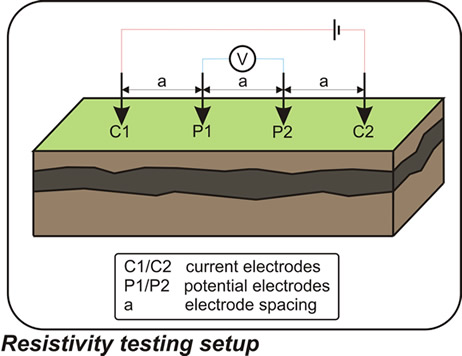
 As part of our services for energy and infrastructure, TerraDat regularly carries out soil resistivity measurements for earthing installation design and corrosion engineering. These resistivity measurements are made by passing a DC electrical current through the ground using a pair of electrodes and measuring the resulting potential gradient within the subsurface using a second electrode pair. There are a number of different electrode configurations, and by gradually increasing the spacing between the current/potential electrodes, the depth of investigation is increased.
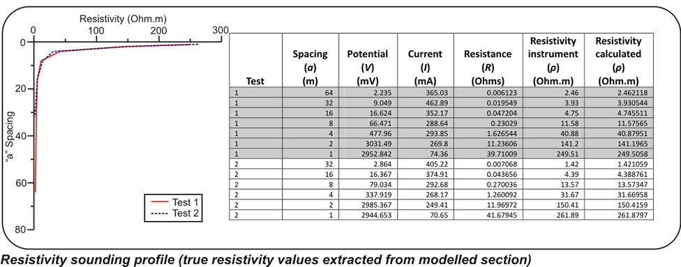
Traditionally, these tests are carried out using a 4-pin survey technique, which provides a vertical electrical sounding profile at a central location point. However, this survey approach has some inherent limitations which include:
An assumption of lateral homogeneity of the ground within the test area which may be up to 150m away from the central test location point for deeper readings.
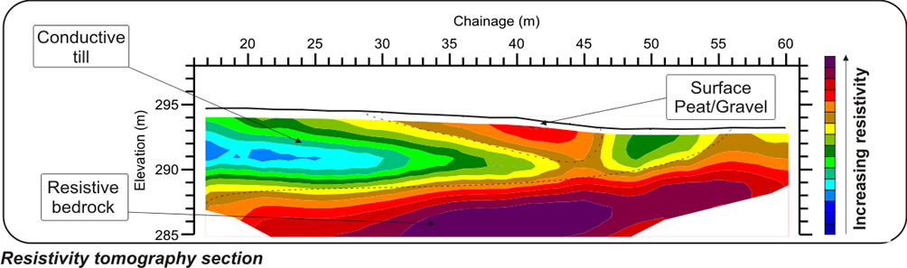
Moving beyond the traditional 4-pin survey, we adopt a sophisticated multi-electrode resistivity tomography approach.
This method overcomes the limitations of standard tests, such as the assumption of lateral ground homogeneity and topographical neglect.
Our approach yields both true and apparent resistivity values, providing a comprehensive cross-sectional view of subsurface conditions, including geological and hydrological variations. This detailed insight ensures more accurate earthing designs and corrosion engineering solutions.”