

Seismic methods can provide detailed information about rock properties and geological structure between boreholes. Fewer boreholes are needed to achieve a continuous picture of the subsurface, thereby reducing overall costs and the risk of missing target features. Borehole seismic methods largely fall into two categories: Crosshole Seismics and Seismic Tomography.
Crosshole Seismics typically involves shooting at regular depth intervals from one borehole to another and simply deriving the velocity of the signal travelling between them. Given the measured velocities, it is possible to derive elastic modulae for the material between the boreholes as it varies with depth. Carrying out a survey using compressional (P) waves and shear (S) waves enables the derivation of Poisson’s ratio. In contrast, the introduction of density information (from measurement or estimation) enables the derivation of Bulk Modulus and Shear Modulus values.
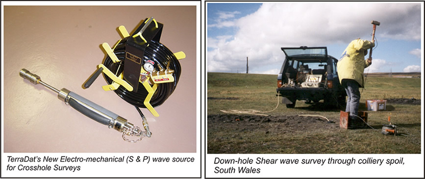
Borehole Seismic Tomography typically involves shooting at discrete depth intervals in one borehole and measuring the velocity of the signal travelling to multiple receivers at different depths in another borehole. Using this method, data are acquired along a great number of ray paths between boreholes, enabling the derivation of a detailed image of the rock mass through tomographic inversion of the data. The method can be used to resolve features such as voids, large fracture zones and geological structures where contrasting lithologies are encountered.
Typical Targets: Geological Hazards
Elastic Modulae
Fracture Zones
Caves/Stopes/Adits
Rock Structure
Benefits of Borehole Seismics:
Cost Efficient
Images Between Boreholes
Good Productivity
Non-invasive
Environmentally Friendly
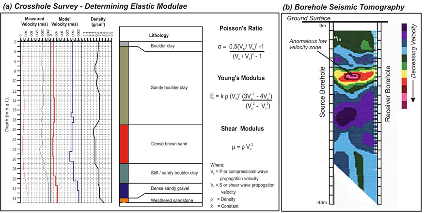
The dynamic elastic modulus of the rock mass between boreholes can be readily derived using Crosshole seismic methods. Density information is required for some modulae and may be estimated from known lithological properties, measured directly in the field/lab or derived from a borehole logging survey. (b) the identification of low-velocity zones such as a cavity/solution feature, fracture zone or workings is a common requirement of seismic tomography surveys. They are clearly observed on the resulting tomogram.