

Twenty years ago, geophysics specialists at TerraDat became involved in a major pan-European project to measure the impact of climate change on permafrost in the mountains of Europe.
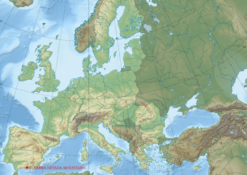
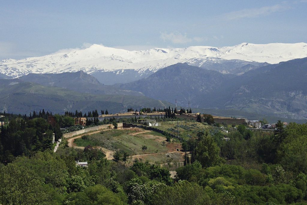
The PACE (Permafrost And Climate in Europe) Project began monitoring a large area of permafrost between Svalbard in the north and the Sierra Nevada mountains in Spain in the south.
The study, coordinated by Cardiff University and funded by the EU, was designed to map and measure the permanently-frozen layer under the surface of the Earth. TerraDat was an industrial partner.
In Europe, the permafrost is found largely in mountainous regions where the temperatures are only a few degrees below zero. That makes European mountain permafrost highly sensitive to projected climate changes in the 21st century.
Permafrost makes up 24% of the exposed land in the northern hemisphere, more than 22 million square kilometres.
It is made up of permanently-frozen gravel, sand, rocks, and soil and much of it has been present since the last Ice Age. Permafrost thickness ranges from one metre to more than 1,000 metres.
Studying permafrost, its distribution, and how it is degrading is an important part of understanding how our climate has changed and is changing, and to map the risks from those changes.
Evidence from the Swiss Alps already suggests permafrost warming has taken place in the past 10 years, heightening the instability of mountain slopes and increasing the risks of avalanches or landslides.
Now, TerraDat’s team has revisited the Sierra Nevada mountain range in Spain to benchmark how permafrost in the area has changed over the last two decades.
TerraDat Director and Founder Nick Russill said: “We’re working on the results of the fieldwork from this year’s survey right now, but we’re expecting it to show that climate change has impacted the permafrost in the area over the past 20 years and that it is degrading.
“This can cause serious problems for people and infrastructure in high mountainous areas, for example in ski resorts.
“Degrading permafrost makes the ground less stable and more prone to landslides and avalanches, and that impacts on infrastructure like roads and the foundations of buildings as well as the safety of the people visiting them and living in these areas.
“Undertaking geophysical surveys like these helps local authorities know they need to take urgent remedial action and it helps architects and engineers know that they need to design and build infrastructure and buildings to resist these ground changes.
“Anecdotal evidence is already pointing in the direction of permafrost degradation. Local people have been using cracks in the frozen ground as a place to store meat and keep it fresh since medieval times. However now, they’ve noticed that the meat is starting to spoil and go off when they do that. They believe the ground is warming.
“When we became involved with the PACE project, our TerraDat team visited sites in Spain, Switzerland, France, and Norway to support our scientific partners in the research with geophysics.
“Geophysics provides a great tool for investigating the subsurface with minimal impact at the surface which is so important in pristine mountain environments.
“We use electrical resistivity to look at the different areas below the ground’s surface. Permafrost shows a much higher resistivity than the ordinary ground.
“Electrical current is injected into the ground via electrodes and data is collected by a resistivimeter. Hundreds of these measurements build a high-resolution image of the terrain.
“We then produce cross-sections of the ground where these anomalies caused by permafrost lie.
“The original project lost funding after five years, but the scientific teams in Switzerland, Spain, and at TerraDat kept in touch and we decided to send a TerraDat team back to the Sierra Nevada mountains under Christian Hauck.
“Techniques have also improved in the past 20 years, and increased automation means that readings can now be taken more regularly.
“Revisiting those PACE sites will allow us to see if the areas we measured 20 years ago have shrunk. If so, there can only be one cause: the permafrost is degrading because of climate change.”
What was the PACE Project’s goal?
The initial goal was to establish permafrost monitoring stations across the continent, achieved by drilling six deep boreholes in frozen bedrock between 1997 and 2001. Each was lined with plastic and contained monitoring equipment.
The boreholes were sited near weather monitoring stations which also gave a picture of air temperatures and weather conditions.
Information was gathered about permafrost temperatures which was extrapolated to unmeasured areas by the mapping of the permafrost distribution.
It was coupled with data on ground thermal conditions from geophysical prospecting, spatial modelling, and remote testing.
TerraDat’s team had a goal of establishing the characteristic geophysical properties of permafrost and designing a survey strategy to best identify it at marginal sites at risk of change.
Other participants in the project included teams from Spain, Switzerland, Norway, Italy, Germany, and Sweden.
The researchers came from the Justus Liebig Universität – Giessen, Germany, the Swiss Federal Institute of Technology in Zurich, the University of Zurich, the Universià degli Studi di Roma Tre, Stockholm University, the University of Oslo, Geoland di Nardo Alessandro, Universià degli Studi di Roma Tre, and Universidad Complutense, Madrid.
You can find out more about the PACE Project here.
Why is measuring the permafrost so important?
Variations in permafrost temperature can be a sensitive indicator of climate change.
Inversion modelling is used to estimate the impact of thermal surface changes over years, decades, and hundreds of years.
There is also another worrying aspect to the degradation of permafrost.
It contains organic matter which has trapped substantial amounts of carbon. As the permafrost melts, that carbon is released into the atmosphere as carbon dioxide or methane, feeding a climate change loop and potentially making the climate emergency worse.
Alongside the release of damaging gases, permafrost melt can cause erosion, landslides, subsidence, and even the disappearance of lakes.
It could also change which plant species are found at high latitudes.
How could this testing help your business?
TerraDat is increasingly offering the electrical resistivity, or electrical tomography, techniques they used in the Sierra Nevada as a commercial service and it has a satellite office in Innsbruck to serve the high mountain areas of Europe.
If you’re embarking on a major infrastructure, engineering, or development project in mountainous areas, a geophysical survey will help warn you about any potential for permafrost thaw and ground movement.
Call us on +44 (0) 2920 700127 for more information.
If you want to learn more about geophysical techniques, take a look at our useful guide to the subject.