

Addressing the growing challenge of environmentally compliant landfill management, TerraDat provides expert geophysical survey services for both active and closed landfill sites. Our advanced, non-invasive techniques deliver high-resolution insights into landfill composition and boundaries, surpassing traditional methods in efficiency and cost-effectiveness. This approach is critical in an era of stringent environmental legislation and often incomplete historical records of landfill sites.
- Mapping leachate level within landfills
- Locating landfill boundaries
- Characterising variations in waste composition
- Mapping “dry” and “wet” zones for leachate control
- Investigating cap integrity
- Geological characterisation for new cell design
- Leachate plume mapping
- Locating voids or poorly compacted zones
- Landfill HDPE Liner testing
- Locating underground springs
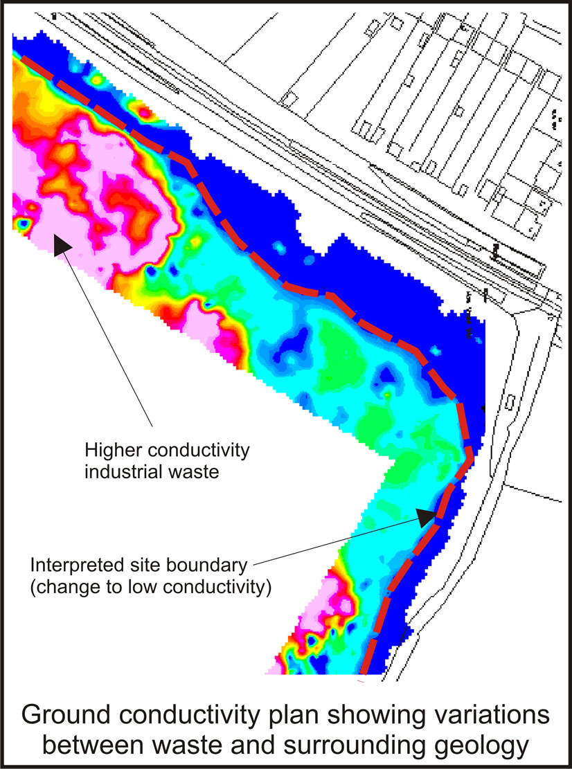
The plan shows how conductivity mapping can be used to rapidly locate the boundaries of a closed landfill where records are missing.
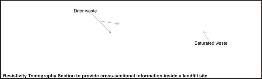
The section below is from a resistivity tomography survey and shows variations within a landfill cell, including wet and dry waste, the landfill base and bedrock characteristics. Up to 1.5km of line can be acquired in one day.
Characterising the internal composition of a landfill is an important factor when considering the contamination potential and future of either an active or abandoned site. Placing random boreholes and probes can be costly and ineffective with non-existent or incomplete records. Knowledge about lateral changes in the properties of a landfill can identify features such as tip boundaries, different phases of tipping, saturated and dry ground, leachate plumes, and areas of groundwater ingress.
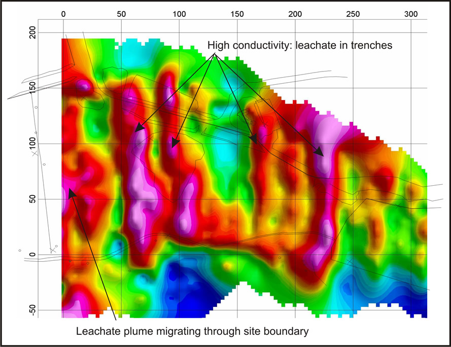
The purple lineations represent high conductivity in trenches that were excavated into the underlying clay and filled with industrial waste. Subsequent groundwater ingress caused leachate accumulations that concentrated in the trenches.
Further processing of the electromagnetic data showed the leachate plumes to be migrating towards the site boundary, thus providing optimal locations for pumping wells.